Wave Impact on Harbours
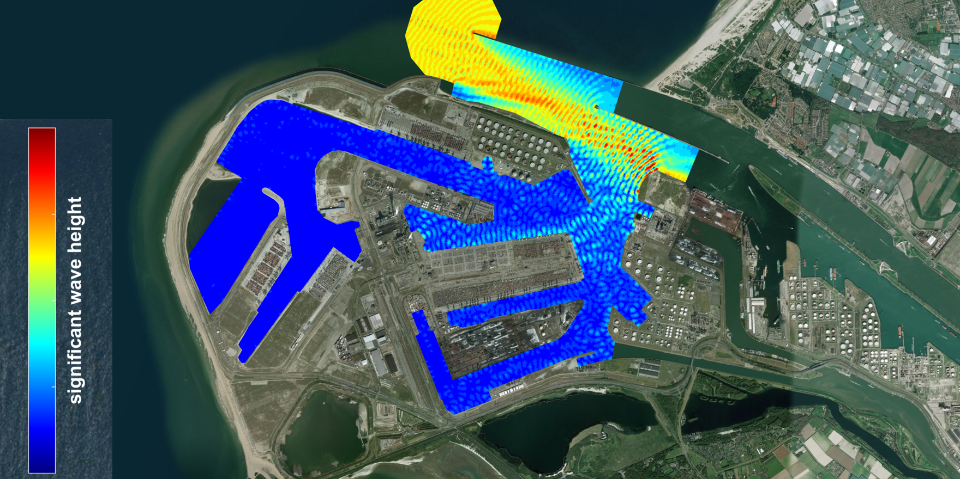
Information on local wave conditions is essential when designing ports, quay walls, jetties or breakwaters. Wave Impact on Harbours (WIHA) shows how waves move through a harbour and how tall they are. By changing the design of the port or the placement of breakwaters in the digital model, numerous variants can be calculated and clearly displayed.
View multiple solutions quickly and in detail
WIHA enables the quick and accurate calculation of wave conditions in and around a harbour. Processes such as wave dispersion, diffraction, refraction and reflection are playing an important role. Once the relevant local data has been loaded, various solutions can be examined in detail with short simulation times. This makes the programme both advanced and user-friendly.
WIHA can be used in the design of harbours and breakwaters and the assessment of flood safety risks, and it can provide input for mooring analyses. This makes WIHA suitable not only for the design of new ports but also for the analysis of identified problems.
Ease of use and on-site model
Across the world, there are various models for calculating waves. WIHA’s ease of use distinguishes it from alternatives. Making use of a user-friendly GIS (Geographical Information System), a model can be created on location. The calculations can then be made and the results displayed.
This makes it possible to create different models and perform calculations during work sessions with designers.
Why Wave Impact on Harbours?

Fast an accurate calculations
WIHA makes quick and accurate calculations of wave conditions in and around a harbour. As a result, different models can be created relatively quickly.

User-friendly
WIHA is sophisticated and user-friendly. This makes it for example easy to change the port design or placement of breakwaters.

Widely deployable
WIHA can provide input for mooring analyses, and it can be used in the design of harbours and breakwaters and the assessment of flood safety risks.

Want to know more?

Wim is committed to creating sustainable and climate-adaptive living environments.
