InfraShaper
When, as a municipality or province, you want to redesign an existing road, several variants for the road profiles are often examined. Often, these road profiles come from manuals and relevant guidelines, but lack the link to the existing situation. It is a complicated task to finally choose which variant fits best in the actual situation. The InfraShaper offers help.
Facilitates the decision-making
There are several reasons why municipalities and provinces decide to redesign a road. For instance, because cars drive too fast, the road is too narrow for large traffic or because there is a need for more green space. Different road profiles are then drawn up, but the selection process is often long, complex and confusing. With the InfraShaper, different variants can be quickly compared, which helps to simplify the selection process and makes the spatial impact of the new road profiles immediately clear.
How does it work?
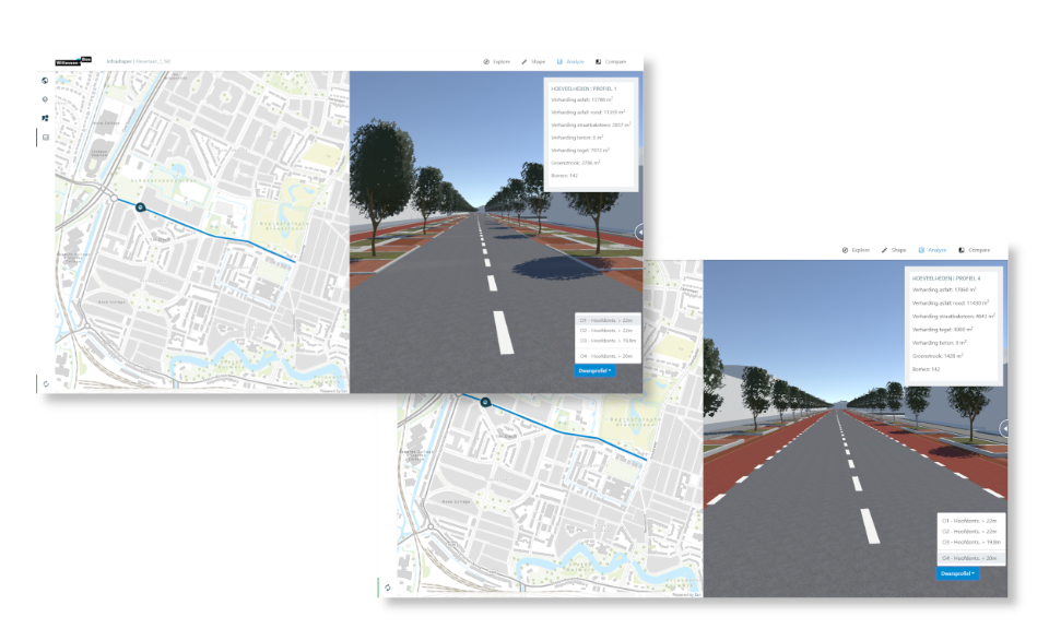
The province or municipality provides certain road profiles. These road profiles are then converted into 3D building blocks. These building blocks also directly contain the guidelines of how to deal with different widths of road profiles. For example, a stretch of street may be wider or narrower than the profile to be placed. Sometimes the pavement can simply be stretched or shortened, but sometimes there are other rules to follow.
Switching between road profiles
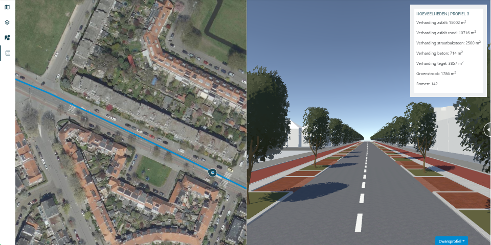
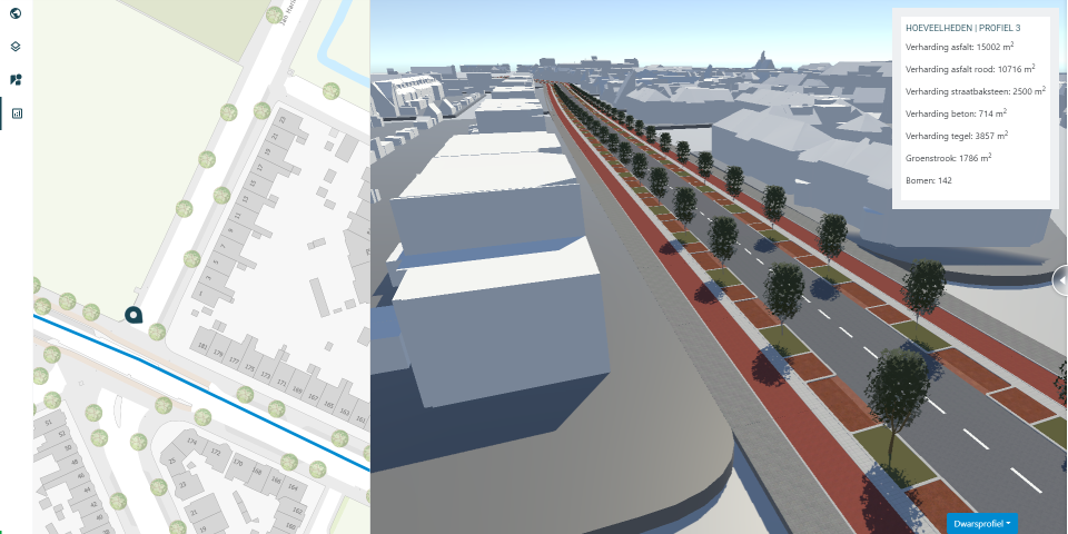
A web application is prepared for the relevant municipality or province. In this application a street can be selected from a map. After selecting the street, a 3D representation of the existing situation appears. In this 3D environment, different road profiles can be projected in the existing situation. This makes it easy to compare several road profiles with each other, including the overall quantities, materials and costs required. Think of required quantities of (red) asphalt, concrete tiles and trees. This provides early insight into the global quantities and additional costs.
Visual comparison
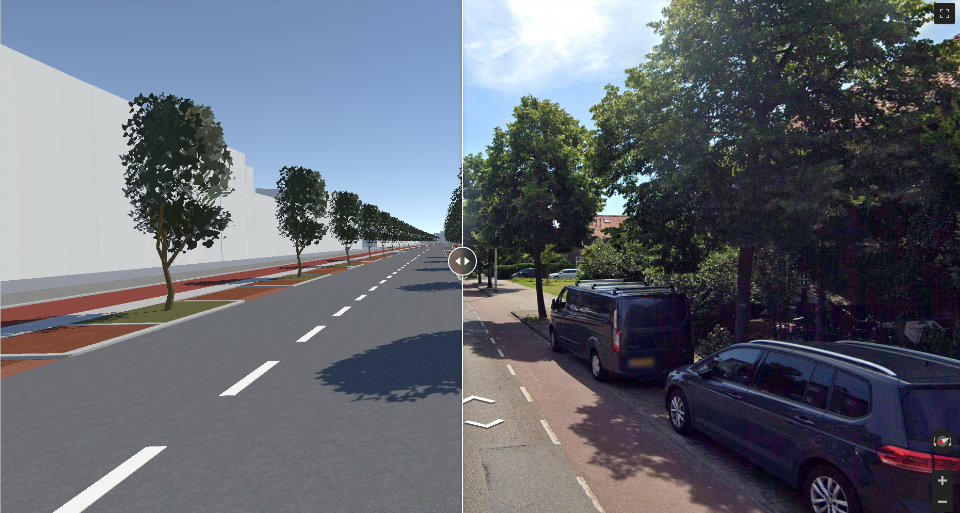
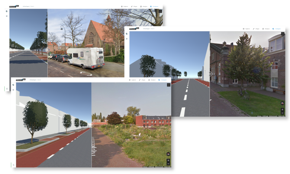
A comparison is also made with the current streetscape through a Google Maps Streetview Overlay. This offers the advantage that the difference between the current and future situation can be seen immediately. In addition, this overlay helps with citizen participation. Indeed, the comparison with the old situation makes it more recognisable and understandable for citizens.
Applicable for all streets
The 3D road profile building blocks can be used for any street if the right design guidelines are provided. Think of guidelines such as: in this street, the road profile should start 30 cm from the cadastral boundaries, the pavement must always be at least 120 cm wide, et cetera. So when the road profiles and rules are known, you can use these models for all streets within the intended area.
Advantages of the InfraShaper

Overview
The tool provides instant insight into the required quantities, materials and costs per variant. This allows the choice between variants to be made quickly and early in the process.

Quick comparison
With the InfraShaper, different variants can be quickly compared. The new streetscape can be compared with the current streetscape thanks to an intuitive overlay with Google Streetview.

Deployable for all streets
Once the 3D building blocks of road profiles are created, they can be used for all streets within the intended area.

Want to know more?

Erik is a software developer who is specialised in building 3D applications used for visualisations, simulations and digital twins.
